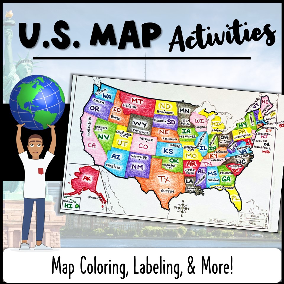
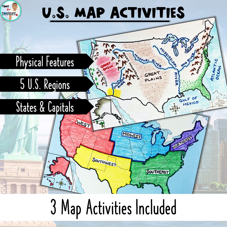
Teaching about the geography of the U.S.? These three map activities will help! Included are: States & Capitals, Physical Features, and the 5 U.S. Regions. This print-and-go resource is No-Prep and great for independent learners. In addition, Google compatible links are provided so that directions, sample maps, and self-assessments can be used digitally!
Benefits:
– No prep-work or planning is needed!
– Great addition to American History lessons.
– Student-centered for independent use.
– Excellent resource to keep in your Emergency Sub Folder.
INCLUDED:
– Three Map Activities
- States & Capitals
- Physical Features
- 5 U.S. Regions
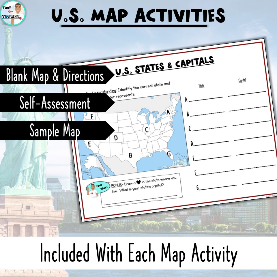
– Blank, printable maps.
– Student-friendly directions.
– “Check for Understanding” Self-Assessments.
– Sample, completed maps to use as guides.
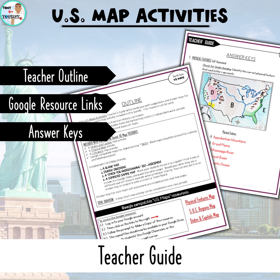
– A Teacher Guide
- Teacher Outline
- Links to Google compatible resources
- Answer Keys for self-assessments
Looking for similar or related resources? Check these out:
Continents & Oceans, Map Skills
Learning About Maps
American / U.S. History Curriculum Bundle
Westward Expansion Full Unit
—————————————————————————————————————————
Like this resource? “Tony the Tourist” is part of a growing series that offers a fun and interactive way to teach social studies to upper elementary and middle school students. FOLLOW ME, and you will be the first to know about new resources, freebies, and where Tony is going next!